Bormio 360
Bormio
Stage 1

The Water Trail

Pravasivo - Torri di Fraele

KM
11,8 Km
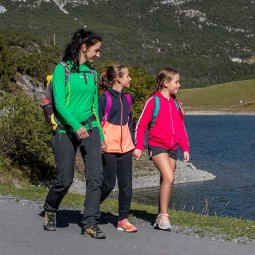
  • famigliaapiediFamily walks
  • termeThermal spa

The stage starts from the convenient Pravasivo parking area, just below the "Old" Baths of Bormio, on the slopes of the Reit crest, and ends at the Towers of Fraele in Valdidentro.


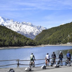
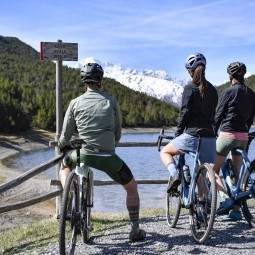
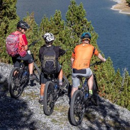
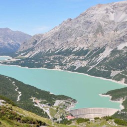
The trail is passable on foot or by mountain bike, does not present particular difficulties, and crosses a landscape characterized by the roar of water in all its forms: the thermal waters, already known in Roman times, the river Adda, the Cancano dams, the hydroelectric pipelines, and the lake, Lago delle Scale, fed by underground springs.

Details


The first stage of the Bormio 360 trail takes you through a landscape dominated by water in all its forms. From the Pravasivo car park follow the trail behind a small lodge belonging to the Stelvio National Park, then continue along the main road until you reach Boscopiano (an alternative route is being built through the Adda gorge, away from the main road, though it won’t be ready for a couple of years). An uphill stretch along the unpaved N184 road leads to Rifugio Solena, passing the Malga di Boscopiano and Alpe Solena. Here you can find a small church dedicated to Saint Erasmus built by the company A2A in 1934 in memory of those who died during the construction of the Val Fraele dams and other large A2A hydroelectric projects in Valtellina. The route continues across the dam and Lake Scale until it reaches the Fraele Towers. There are a number of places to stop on the way and enjoy the local cuisine: Ristoro Solena, Ristoro Monte Scale and Chalet Villa Valania.

Technical info

Bussola
  • Difficulty: Easy
  • Distance: 11,89 Km
  • Hiking time: 4 h
  • Max. altitude: 1995 m
  • Min. altitude: 1409 m
  • Elevation gain: 811 m
  • Elevation drop: 281 m
  • Max. grad. ascent: 20%
  • Max. grad. descent: 19%
  • When to go: May - October

Details


The first stage of the Bormio 360 route is mainly uphill, starting from the Pravasivo car park on the road to the Stelvio Pass. The trail runs from behind a small lodge owned by the Stelvio National Park before joining the main road via an access ramp (watch out for cars!). Continue along the paved road for around 3 km (an alternative route is being built through the Adda gorge, away from the main road, though it won’t be ready for a couple of years), then turn left towards Boscopiano along an unpaved, though even surface until your reach the small Solena church, with panoramic views over the dams at Cancano. The flat final section winds through the Stelvio National Park until you reach another panoramic viewpoint over Valdidentro, the Fraele Towers.

There are a number of places to stop off and enjoy some of the local cuisine: Ristoro Solena, Ristoro Monte Scale and Chalet Villa Valania.

Charging points: The bike rental shop near the Monte Scale refuge.

Technical info

Bussola
  • Difficulty: Medium
  • Distance: 11,89 Km
  • Max. altitude: 1995 m
  • Min. altitude: 1409 m
  • Elevation gain: 811 m
  • Elevation drop: 281 m
  • Max. grad. ascent: 20%
  • Max. grad. descent: 19%
  • When to go: May - October
  • Battery consumption: High

Discover the other stages

1
KM
12 Km

Decauville Trail

Towers of Fraele - Arnoga

Discover the stage
2
KM
19 Km

The Count’s Trail

Arnoga - San Colombano

Discover the stage
3
KM
17 Km

The Trail of the Alpine Dairies

San Colombano - Alpe Zandilla

Discover the stage
4
KM
18 Km

The Mineral Trail

Alpe Zandilla - Sondalo Palazzetto

Discover the stage
5
KM
9 Km

Trail of Li Stria

Sondalo Palazzetto - Fontanaccia

Discover the stage
6
KM
12,7 Km

The Trail of Rhododendrons

Fontanaccia - Malga dell'Alpe

Discover the stage
7
KM
13 Km

The Trail of Ice

Malga dell'Alpe - Forni

Discover the stage
8
KM
21 Km

The Confinale Trail

Forni - Fantelle

Discover the stage
9
KM
8,5 Km

The Spirits Trail

Fantelle - Pravasivo

Discover the stage
Indietro
Avanti
img1

Adventure
for all,
done the
right way.

trekking

At 140 km in length, with an overall height difference of 6,000 m, Bormio 360 is one of the best hiking and mountain biking itineraries in Europe. It requires a good level of fitness, agility and experience. Going with a qualified mountain bike or hiking guide is recommended.

1

Always follow the Bormio 360 marked trails.

Only use authorised routes and respect the rules.

Motivo

2

Protect the environment.

Never scare animals, don’t litter and avoid sudden braking (it erodes the soil).

3

Make sure you have suitable clothing and equipment.

Check your equipment and always use a helmet and gloves.

arrow
arrow

4

We’re all friends on the mountain.

Always give way to hikers, announce your presence in advance, adjust your speed to the situation and don’t exceed your own limits.

5

Know yourself, respect your limits.

Plan your excursions in advance. It’s always a good idea to go with a qualified guide!

img2

Partner organisations

img
img
img
img
img
Indietro
Avanti
Attention, Stage 6 - Sentiero De Li Strìa not passable. Use Easy Stage.